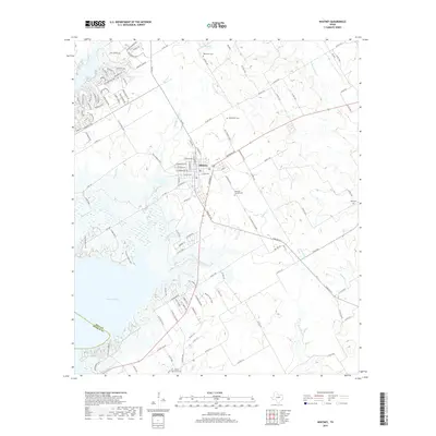
2019 Map of Whitney
USGS Topo · Published 2019About this map
The town of Whitney serves as the central hub of this 2019 survey, situated at the intersection of several farm-to-market roads and local thoroughfares. The landscape transitions from the residential street grids of the town center to the recreational and riparian terrain surrounding Lake Whitney and Lofers Bend Park. The area is notably defined by its many watercourses, including Towash Cr, Whiterock Cr, and Little Aquilla Cr, which drain the surrounding prairie lands. Local history is anchored by a significant number of cemeteries distributed across the countryside, such as Oak Grove Cem, Bethlehem Cem, and Whitney Towash Cem. The map illustrates the contemporary development of lakeside communities, where names like Quarter Horse Rd and Appaloosa Trl reflect a modern residential character near the shoreline.
Find a feature on this map
123 named features on this map. Tap any name to fly to it.
Don’t see what you’re looking for? This feature index may not catch every label — zoom into the map to look around manually.
Map Details
Editions of this 2019 Whitney Map
This is the sole edition of this map. No revisions or reprints were ever made.
Other maps of this area

1891 · Cleburne
USGS Topo · 1:125,000

1892 · Waco
USGS Topo · 1:125,000

1894 · Cleburne
USGS Topo · 1:125,000

1920 · Waco
USGS Topo · 1:125,000

1924 · Waco 2-b
USGS Topo · 1:48,000

1924 · Cleburne 3-C
USGS Topo · 1:48,000

1927 · Blum
USGS Topo · 1:62,500

1931 · Whitney
USGS Topo · 1:62,500

1954 · Dallas
USGS Topo · 1:250,000

1954 · Waco
USGS Topo · 1:250,000