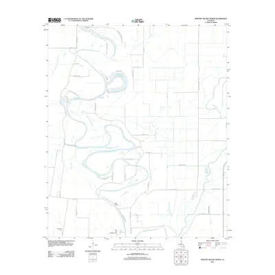
2012 Map of Whitney Island North
USGS Topo · Published 2012About this map
Bayou Bonne Idee meanders extensively through this Morehouse Parish landscape, creating a complex series of oxbows and cutoffs that define the local geography. The settlement of Moss Bridge serves as a focal point near the southern reach of the bayou, surrounded by a network of rural roads such as Lizard Rd and Pud Clack Rd. The presence of Wimberley Cem in the southwestern corner provides a specific site for genealogical interest within this floodplain environment. To the east, the Boeuf River and Turkey Bayou parallel the main drainage system, illustrating the intricate hydrography of the Louisiana delta. The map details several distinct water bodies created by the shifting course of the bayou, most notably Horseshoe Lake and Deer Lake, which are linked by smaller channels like E Fork Cr.
Find a feature on this map
48 named features on this map. Tap any name to fly to it.
Don’t see what you’re looking for? This feature index may not catch every label — zoom into the map to look around manually.
Map Details
Editions of this 2012 Whitney Island North Map
This is the sole edition of this map. No revisions or reprints were ever made.
Other maps of this area

1935 · Collinston
USGS Topo · 1:62,500

1935 · Naff
USGS Topo · 1:62,500

1935 · Hurricane
USGS Topo · 1:62,500

1935 · Bonita
USGS Topo · 1:62,500

1955 · Jackson
USGS Topo · 1:250,000

1956 · Bastrop
USGS Topo · 1:62,500

1957 · Collinston
USGS Topo · 1:62,500

1958 · Hurricane
USGS Topo · 1:62,500

1958 · Bonita
USGS Topo · 1:62,500

1961 · Jackson
USGS Topo · 1:250,000