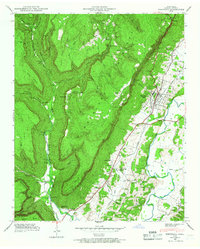
1946 Map of Whitwell
USGS Topo · Published 1966About this map
Whitwell Mine sits at the base of the dramatic eastern escarpment of the Cumberland Plateau, serving as a focal point for the local economy during the mid-1940s. The settlement of Whitwell is concentrated in the valley along the Nashville and Chattanooga railroad line, which facilitated the movement of coal and agricultural goods through the Sequatchie River valley.
Find a feature on this map
70 named features on this map. Tap any name to fly to it.
Don’t see what you’re looking for? This feature index may not catch every label — zoom into the map to look around manually.
Map Details
Editions of this 1946 Whitwell Map
3 editions found
Other maps of this area

1888 · Chattanooga
USGS Topo · 1:125,000

1893 · Chattanooga
USGS Topo · 1:125,000

1895 · Sewanee
USGS Topo · 1:125,000

1936 · Palmer
USGS Topo · 1:24,000

1936 · Daus
USGS Topo · 1:24,000

1936 · Whitwell
USGS Topo · 1:24,000

1936 · Tracy City
USGS Topo · 1:24,000

1936 · Ketner Gap
USGS Topo · 1:24,000

1936 · White City
USGS Topo · 1:24,000

1936 · Wauhatchie
USGS Topo · 1:24,000