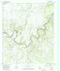
1973 Map of Whon
USGS Topo · Published 1988About this map
The Colorado River carves a deep, winding path through the borderlands of Coleman and McCulloch counties, defining a landscape of sharp relief and historic river crossings. This 1970s survey captures the rural character of Whon, where the local Whon Cem and a solitary grave near the riverbank serve as essential markers for genealogists. The terrain is dominated by prominent elevations such as Parks Mountain and Round Mountain, which overlook a series of traditional fords including Military Crossing and Knight Crossing.
Find a feature on this map
27 named features on this map. Tap any name to fly to it.
Don’t see what you’re looking for? This feature index may not catch every label — zoom into the map to look around manually.
Map Details
Editions of this 1973 Whon Map
2 editions found
Other maps of this area

1887 · Coleman
USGS Topo · 1:125,000

1889 · Coleman
USGS Topo · 1:125,000

1894 · Brady
USGS Topo · 1:125,000

1924 · Brady 2-a
USGS Topo · 1:48,000

1925 · Brady 2-b
USGS Topo · 1:48,000

1925 · Brady 1-b
USGS Topo · 1:48,000

1928 · Mercury
USGS Topo · 1:62,500

1928 · Waldrip
USGS Topo · 1:62,500

1950 · Mercury
USGS Topo · 1:62,500

1954 · Brownwood
USGS Topo · 1:250,000