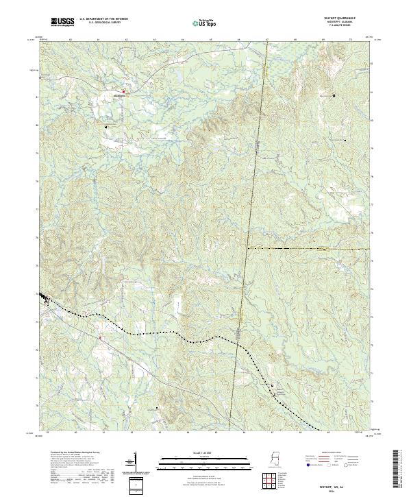
2024 Map of Whynot
USGS Topo · Published 2024About this map
Alamucha sits at the heart of this landscape where the undulating hills of East Mississippi meet the Alabama state line. The area is defined by a dense network of watercourses, including the winding Alamuchee Creek and Yantley Creek, which have historically shaped the drainage and movement through these borderlands. The settlement pattern is largely rural, oriented around local connectors like Old Wire Rd and Alamucha Whynot Rd.
Find a feature on this map
59 named features on this map. Tap any name to fly to it.
Don’t see what you’re looking for? This feature index may not catch every label — zoom into the map to look around manually.
Map Details
Editions of this 2024 Whynot Map
This is the sole edition of this map. No revisions or reprints were ever made.
Other maps of this area

1921 · Meridian
USGS Topo · 1:48,000

1923 · Meridian
USGS Topo · 1:62,500

1953 · Meridian
USGS Topo · 1:250,000

1957 · Meridian
USGS Topo · 1:250,000

1957 · Quitman
USGS Topo · 1:62,500

1965 · Meridian
USGS Topo · 1:250,000

1971 · Vimville
USGS Topo · 1:24,000
1971 · Toomsuba
USGS Topo · 1:24,000

1974 · Yantley
USGS Topo · 1:24,000

1974 · Ward
USGS Topo · 1:24,000