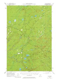
1953 Map of Whyte
USGS Topo · Published 1976About this map
The Duluth Missabe and Iron Range Railroad defines the industrial character of this Lake County landscape during the early 1950s. This rail network, alongside the Reserve Mining Company Railroad, connects a series of junctions and small settlements such as Whyte, McNair, and Scott Junction. The area is deeply integrated with the timber and iron ore economies, evidenced by the numerous Gravel Pits and the extensive Old Railroad Grade that winds through the Superior National Forest.
Find a feature on this map
52 named features on this map. Tap any name to fly to it.
Don’t see what you’re looking for? This feature index may not catch every label — zoom into the map to look around manually.
Map Details
Editions of this 1953 Whyte Map
3 editions found
Other maps of this area

1952 · Babbitt SE
USGS Topo · 1:24,000

1953 · Whyte
USGS Topo · 1:62,500

1954 · Greenwood Lake
USGS Topo · 1:62,500

1954 · Silver Bay
USGS Topo · 1:62,500

1954 · Two Harbors
USGS Topo · 1:250,000

1955 · Isabella
USGS Topo · 1:62,500

1956 · Split Rock Point
USGS Topo · 1:24,000

1956 · King Lake
USGS Topo · 1:24,000

1956 · Split Rock Point
USGS Topo · 1:62,500

1957 · Two Harbors
USGS Topo · 1:250,000