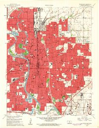
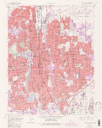
1961 Map of Wichita East
USGS Topo · Published 1961About this map
The Arkansas River curves through a rapidly expanding urban landscape in this early 1960s view of south-central Kansas. The city is characterized by a dense grid of neighborhoods, many defined by their local parks like Sim Memorial Park and Linwood Park. Educational and religious institutions are particularly prominent, including Friends University and numerous parochial schools such as Our Lady of Perpetual Help Sch and St Marys Academy.
Find a feature on this map
153 named features on this map. Tap any name to fly to it.
Don’t see what you’re looking for? This feature index may not catch every label — zoom into the map to look around manually.
Map Details
Editions of this 1961 Wichita East Map
5 editions found
Other maps of this area

1889 · Wichita
USGS Topo · 1:125,000

1894 · Wichita
USGS Topo · 1:125,000

1941 · Maize
USGS Topo · 1:31,680

1941 · Valley Center
USGS Topo · 1:31,680

1942 · Valley Center
USGS Topo · 1:31,680

1942 · Maize
USGS Topo · 1:31,680

1943 · Wichita West
USGS Topo · 1:31,680

1943 · Wichita East
USGS Topo · 1:31,680

1943 · Derby
USGS Topo · 1:31,680

1943 · Bayneville
USGS Topo · 1:31,680