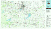
1985 Map of Wichita Falls
USGS Topo · Published 1985About this map
The energy-rich landscapes of North Texas are well defined in this mid-1980s study, where the expansive Electra Oil Field and K M A Oil Field dominate the western horizon near Electra. This era shows Wichita Falls as the central urban and transportation hub, bordered by Sheppard Air Force Base to the north and the recreational waters of Lake Arrowhead to the southeast.
Find a feature on this map
98 named features on this map. Tap any name to fly to it.
Don’t see what you’re looking for? This feature index may not catch every label — zoom into the map to look around manually.
Map Details
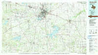
Editions of this 1985 Wichita Falls Map
2 editions found
Other maps of this area

1901 · Addington
USGS Topo · 1:125,000

1905 · Montague
USGS Topo · 1:125,000

1915 · Clara
USGS Topo · 1:24,000

1915 · Barwise School
USGS Topo · 1:24,000

1915 · Burkburnett
USGS Topo · 1:24,000

1916 · Electra
USGS Topo · 1:24,000

1916 · Iowa Park
USGS Topo · 1:24,000

1916 · Fowlkes
USGS Topo · 1:24,000

1917 · Beaver Creek
USGS Topo · 1:24,000

1918 · Buckburnett
USGS Topo · 1:31,680