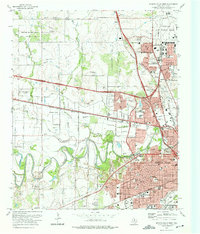
1972 Map of Wichita Falls West
USGS Topo · Published 1975About this map
Sheppard Air Force Base dominates the northern reaches of this landscape, its expansive runways and annexes established as a centerpiece of the regional infrastructure. In the early 1970s, the urban footprint of Wichita Falls pushed westward, marked by a dense concentration of schools like Notre Dame High Sch and institutional landmarks including Midwestern University. The Wichita River snakes through the center of the sheet, bordered by numerous parks such as Lucy Park and Harrell Park, reflecting a city designed around its natural waterways. Transport and industry are tightly integrated, with the Missouri Kansas Texas and Fort Worth and Denver railroads cutting through the terrain. The presence of multiple radio towers and a Drag Strip suggests a community in a period of active mid-century growth, while established sites like Sacred Heart Cem and Riverside Cemetery provide vital points for genealogical research.
Find a feature on this map
88 named features on this map. Tap any name to fly to it.
Don’t see what you’re looking for? This feature index may not catch every label — zoom into the map to look around manually.
Map Details
Editions of this 1972 Wichita Falls West Map
This is the sole edition of this map. No revisions or reprints were ever made.
Other maps of this area

1915 · Clara
USGS Topo · 1:24,000

1915 · Burkburnett
USGS Topo · 1:24,000

1916 · Iowa Park
USGS Topo · 1:24,000

1918 · Buckburnett
USGS Topo · 1:31,680

1918 · Clara
USGS Topo · 1:31,680

1918 · Iowa Park
USGS Topo · 1:31,680

1954 · Wichita Falls
USGS Topo · 1:250,000

1955 · Lawton
USGS Topo · 1:250,000

1956 · Sloop Creek
USGS Topo · 1:24,000

1956 · Lake Wichita
USGS Topo · 1:24,000