
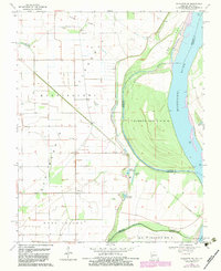
1969 Map of Wickliffe SW
USGS Topo · Published 1972About this map
O'Bryan Ridge and the broad floodplains of the Mississippi River define this corner of the borderlands between Missouri and Kentucky in the late 1960s. The landscape is characterized by a complex network of river features and agricultural drainage, with small settlements like Deventer and Crosno situated amidst a patchwork of levees and field lines. A notable portion of the map is dedicated to the Mississippi Floodway, highlighting the region's historical battle with seasonal inundation and the resulting topography of ridges and sloughs.
Find a feature on this map
24 named features on this map. Tap any name to fly to it.
Don’t see what you’re looking for? This feature index may not catch every label — zoom into the map to look around manually.
Map Details
Editions of this 1969 Wickliffe SW Map
2 editions found
Other maps of this area

1939 · Wickliffe
USGS Topo · 1:62,500

1939 · Charleston
USGS Topo · 1:62,500

1939 · Hickman
USGS Topo · 1:62,500

1939 · Bayouville
USGS Topo · 1:62,500

1951 · Oakton
USGS Topo · 1:24,000

1951 · Wolf Island
USGS Topo · 1:24,000

1951 · Wickliffe SW
USGS Topo · 1:24,000

1951 · Arlington
USGS Topo · 1:24,000

1951 · Wickliffe
USGS Topo · 1:24,000

1952 · Wickliffe
USGS Topo · 1:62,500