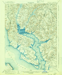
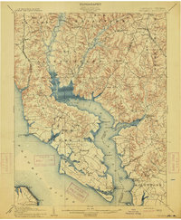
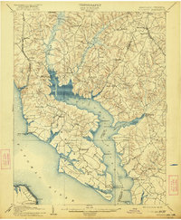
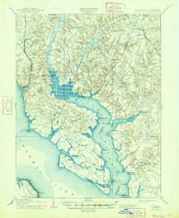
1914 Map of Wicomico
USGS Topo · Published 1941About this map
The Wicomico River carves a deep inlet through Charles and St. Marys counties, creating a complex shoreline of points and bays in the years before the First World War. This landscape is defined by its maritime connections to the Potomac River, where steamships and sailing vessels relied on landings such as Wilkerson Wharf and Lancaster Wharf for regional trade. Inland, the topography is dominated by the sprawling Zekiah Swamp and Gilbert Swamp, which dictated the placement of early roads and small settlements like Dentsville and Newport.
Find a feature on this map
67 named features on this map. Tap any name to fly to it.
Don’t see what you’re looking for? This feature index may not catch every label — zoom into the map to look around manually.
Map Details
Editions of this 1914 Wicomico Map
4 editions found
Other maps of this area

1889 · Fredericksburg
USGS Topo · 1:125,000

1890 · Mt. Vernon
USGS Topo · 1:125,000

1891 · Mt. Vernon
USGS Topo · 1:125,000

1892 · Leonardtown
USGS Topo · 1:62,500

1892 · Fredericksburg
USGS Topo · 1:125,000

1892 · Prince Frederick
USGS Topo · 1:62,500

1892 · Brandywine
USGS Topo · 1:62,500

1892 · Piney Point
USGS Topo · 1:62,500

1892 · Montross
USGS Topo · 1:62,500

1894 · Wicomico
USGS Topo · 1:62,500