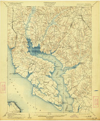
1914 Map of Wicomico
USGS Topo · Published 1922About this map
The Wicomico River serves as the central artery for this Southern Maryland landscape, forming the boundary between Charles and St. Mary’s counties. At the time of this early 20th-century survey, the regional economy relied heavily on water-borne transport, evidenced by numerous landings like Wilkerson Wharf, Lancaster Wharf, and Bushwood Wharf. The rail network provided critical inland connections, with the Philadelphia Baltimore and Washington R. R. cutting through the western terrain near Faulkner, while the W. P. and C. R. R. serves the northern corridor through Charlotte Hall. Inland, the expansive Zekiah Swamp and Gilbert Swamp dominate the northern drainage, giving way to a network of established tobacco-era settlements such as Newmarket, Allens Fresh, and Chaptico. Along the banks of the Potomac River, the map identifies the Ludlow Ferry crossing and the seaside character of Colonial Beach on the Virginia shore.
Find a feature on this map
76 named features on this map. Tap any name to fly to it.
Don’t see what you’re looking for? This feature index may not catch every label — zoom into the map to look around manually.
Map Details
Editions of this 1914 Wicomico Map
4 editions found
Other maps of this area

1889 · Fredericksburg
USGS Topo · 1:125,000

1890 · Mt. Vernon
USGS Topo · 1:125,000

1891 · Mt. Vernon
USGS Topo · 1:125,000

1892 · Leonardtown
USGS Topo · 1:62,500

1892 · Fredericksburg
USGS Topo · 1:125,000

1892 · Prince Frederick
USGS Topo · 1:62,500

1892 · Brandywine
USGS Topo · 1:62,500

1892 · Piney Point
USGS Topo · 1:62,500

1892 · Montross
USGS Topo · 1:62,500

1894 · Wicomico
USGS Topo · 1:62,500