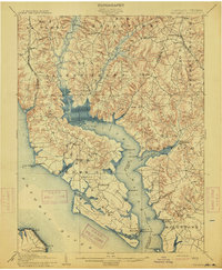
1914 Map of Wicomico
USGS Topo · Published 1914About this map
The Wicomico River carves a deep tidal indentation into the Southern Maryland landscape, serving as a central artery for transportation before modern highway dominance. This 1914 survey illustrates a region defined by its relationship with the water, where maritime commerce was supported by several prominent landing points including Bushwood Wharf, Lancaster Wharf, and Wilkerson Wharf. These wharves, alongside the Ludlow Ferry, highlight a period when river traffic was essential for connecting agrarian settlements like Allen's Fresh and Chaptico to regional markets.
Find a feature on this map
75 named features on this map. Tap any name to fly to it.
Don’t see what you’re looking for? This feature index may not catch every label — zoom into the map to look around manually.
Map Details
Editions of this 1914 Wicomico Map
4 editions found
Other maps of this area

1889 · Fredericksburg
USGS Topo · 1:125,000

1890 · Mt. Vernon
USGS Topo · 1:125,000

1891 · Mt. Vernon
USGS Topo · 1:125,000

1892 · Leonardtown
USGS Topo · 1:62,500

1892 · Fredericksburg
USGS Topo · 1:125,000

1892 · Prince Frederick
USGS Topo · 1:62,500

1892 · Brandywine
USGS Topo · 1:62,500

1892 · Piney Point
USGS Topo · 1:62,500

1892 · Montross
USGS Topo · 1:62,500

1894 · Wicomico
USGS Topo · 1:62,500