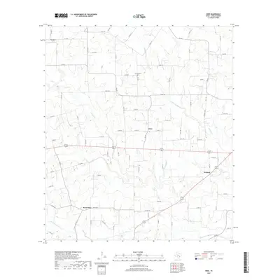
2019 Map of Wied
USGS Topo · Published 2019About this map
Wied and its surrounding ranchlands in Lavaca County are defined by a complex network of seasonal creek branches and farm-to-market roads. This 2019 survey captures the rural layout of south-central Texas, where small crossroads like Worthing and Mount Olive remain tied to the landscape by the drainage of Smothers Cr and Rocky Cr. The placement of Charlottenburg Cem north of the main settlement offers a specific point of interest for genealogists tracing families in this German-influenced region of the state. Transportation is dominated by the modern US Highway 90 alternate route, yet the underlying grid of county roads, such as Co RD 371 and FM 1891, follows the contours of the land, reflecting a layout established by generations of agricultural use. The presence of Dean Ranch Airport in the northwest corner highlights the intersection of traditional land use with modern private aviation in this sparsely populated terrain.
Find a feature on this map
86 named features on this map. Tap any name to fly to it.
Don’t see what you’re looking for? This feature index may not catch every label — zoom into the map to look around manually.
Map Details
Editions of this 2019 Wied Map
This is the sole edition of this map. No revisions or reprints were ever made.
Other maps of this area

1901 · Flatonia
USGS Topo · 1:125,000

1919 · Schulenburg
USGS Topo · 1:62,500

1953 · Seguin
USGS Topo · 1:250,000

1958 · Seguin
USGS Topo · 1:250,000

1962 · Hallettsville
USGS Topo · 1:24,000

1963 · Yoakum
USGS Topo · 1:24,000

1963 · Sweet Home
USGS Topo · 1:24,000

1964 · Ezzell
USGS Topo · 1:24,000

1965 · Wied
USGS Topo · 1:24,000

1965 · Komensky
USGS Topo · 1:24,000