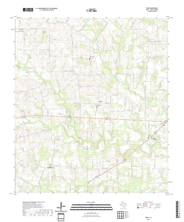
2022 Map of Wied
USGS Topo · Published 2022About this map
Agricultural roots and small-town Texas heritage define this landscape in Lavaca County, where several historic crossroads and family-centered settlements persist. The village of Wied serves as a central point, anchored by Saint Ludmilla's Catholic Cem and a network of county roads that follow the rise and fall of the local creek systems. To the southeast, the small community of Worthing is marked by the Saint Augustine Cem, illustrating the importance of parish and community burial grounds in this part of the state.
Find a feature on this map
91 named features on this map. Tap any name to fly to it.
Don’t see what you’re looking for? This feature index may not catch every label — zoom into the map to look around manually.
Map Details
Editions of this 2022 Wied Map
This is the sole edition of this map. No revisions or reprints were ever made.
Other maps of this area

1901 · Flatonia
USGS Topo · 1:125,000

1919 · Schulenburg
USGS Topo · 1:62,500

1953 · Seguin
USGS Topo · 1:250,000

1958 · Seguin
USGS Topo · 1:250,000

1962 · Hallettsville
USGS Topo · 1:24,000

1963 · Yoakum
USGS Topo · 1:24,000

1963 · Sweet Home
USGS Topo · 1:24,000

1964 · Ezzell
USGS Topo · 1:24,000

1965 · Wied
USGS Topo · 1:24,000

1965 · Komensky
USGS Topo · 1:24,000