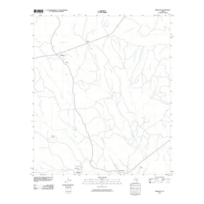
2010 Map of Wiergate
USGS Topo · Published 2010About this map
Mayflower and Burkeville anchor this East Texas landscape, where the rural road network follows the ridges between complex creek systems. Significant for local genealogists, the map identifies several family-named burial sites including Mitchell Cemetery, Mattox Cemetery, and Eddie Gatson Cemetery, which are scattered throughout the timbered terrain. The hydrology of the area is dominated by the northward flow of Little Cow Creek and Royal Creek, along with smaller tributaries like McNorton Branch and Starks Branch. Near the settlement of Wiergate, the Smith Lake Dam creates a local landmark on Smith Lake. The presence of secondary routes like Indian Hill Rd and County Barn Rd illustrates the long-standing land-use patterns and infrastructure connecting these small communities in Newton County.
Find a feature on this map
30 named features on this map. Tap any name to fly to it.
Don’t see what you’re looking for? This feature index may not catch every label — zoom into the map to look around manually.
Map Details
Editions of this 2010 Wiergate Map
This is the sole edition of this map. No revisions or reprints were ever made.
Other maps of this area

1944 · Wiergate
USGS Topo · 1:62,500

1948 · Wiergate
USGS Topo · 1:62,500

1949 · Evans
USGS Topo · 1:31,680

1952 · Lake Charles
USGS Topo · 1:250,000

1953 · Alexandria
USGS Topo · 1:250,000

1954 · Wiergate
USGS Topo · 1:24,000

1954 · Wiergate SE
USGS Topo · 1:24,000

1954 · Fairdale
USGS Topo · 1:24,000

1954 · Wiergate
USGS Topo · 1:62,500
1954 · Haddens
USGS Topo · 1:24,000