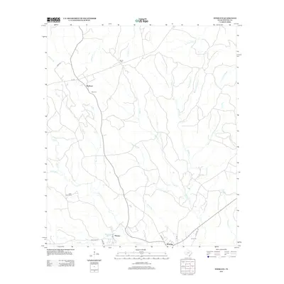
2012 Map of Wiergate
USGS Topo · Published 2012About this map
Mayflower and Wiergate anchor this pocket of East Texas, where the landscape is defined by a dense network of creek branches and family burial grounds. The settlement at Wiergate sits just north of the Little Cow Cr and Smith Lake drainage, while Burkeville occupies the southeastern corner of the quadrangle. For those researching local lineages, the map identifies several small cemeteries, including Mattox Cem, Mitchell Cem, and the Eddie Gatson Cem, often situated near older road alignments like Indian Hill Rd. The hydrologic pattern is particularly intricate here, with numerous parallel tributaries such as Royal Cr, McGraw Cr, and Jeeter Cr feeding toward the south and east. This topographical detail provides a clear view of how early homesteads and road systems were dictated by the varied watercourses of the Newton County timberlands.
Find a feature on this map
33 named features on this map. Tap any name to fly to it.
Don’t see what you’re looking for? This feature index may not catch every label — zoom into the map to look around manually.
Map Details
Editions of this 2012 Wiergate Map
This is the sole edition of this map. No revisions or reprints were ever made.
Other maps of this area

1944 · Wiergate
USGS Topo · 1:62,500

1948 · Wiergate
USGS Topo · 1:62,500

1949 · Evans
USGS Topo · 1:31,680

1952 · Lake Charles
USGS Topo · 1:250,000

1953 · Alexandria
USGS Topo · 1:250,000

1954 · Wiergate
USGS Topo · 1:24,000

1954 · Wiergate SE
USGS Topo · 1:24,000

1954 · Fairdale
USGS Topo · 1:24,000

1954 · Wiergate
USGS Topo · 1:62,500
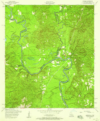
1954 · Haddens
USGS Topo · 1:24,000