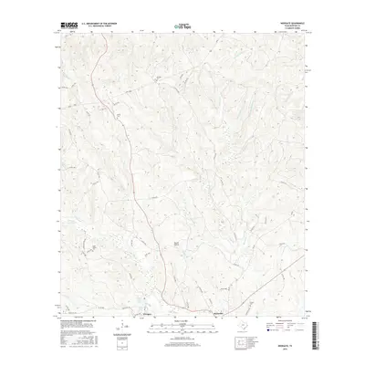
2016 Map of Wiergate
USGS Topo · Published 2016About this map
Burkeville and the nearby community of Wiergate anchor this pocket of East Texas, where the landscape is defined by the branching tributaries of the Sabine River watershed. Local family history is preserved in several small burial grounds, including the Eddie Gatson Cem and Mitchell Cem, which are tucked away among the many creeks. The terrain is marked by notable depressions like Harrol Hollow and the winding course of Little Cow Cr, which flows toward Smith Lake in the southern portion of the area.
Find a feature on this map
63 named features on this map. Tap any name to fly to it.
Don’t see what you’re looking for? This feature index may not catch every label — zoom into the map to look around manually.
Map Details
Editions of this 2016 Wiergate Map
This is the sole edition of this map. No revisions or reprints were ever made.
Other maps of this area

1944 · Wiergate
USGS Topo · 1:62,500

1948 · Wiergate
USGS Topo · 1:62,500

1949 · Evans
USGS Topo · 1:31,680

1952 · Lake Charles
USGS Topo · 1:250,000

1953 · Alexandria
USGS Topo · 1:250,000

1954 · Wiergate
USGS Topo · 1:24,000

1954 · Wiergate SE
USGS Topo · 1:24,000

1954 · Fairdale
USGS Topo · 1:24,000

1954 · Wiergate
USGS Topo · 1:62,500
1954 · Haddens
USGS Topo · 1:24,000