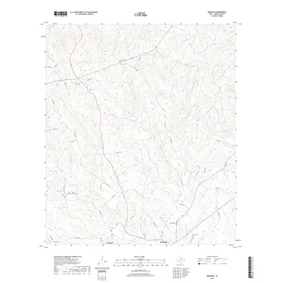
2019 Map of Wiergate
USGS Topo · Published 2019About this map
Wiergate and Burkeville anchor this portion of Newton County, where the landscape is defined by a dense network of creek branches and hollows. The area's history is preserved in small family and community burial grounds, including Mitchell Cem, Mattox Cem, and the Eddie Gatson Cem located near Little Cow Cr. The topography reveals a series of narrow ridges and drainages like Harrot Hollow and Balance Br that feed into larger systems such as McGraw Cr.
Find a feature on this map
60 named features on this map. Tap any name to fly to it.
Don’t see what you’re looking for? This feature index may not catch every label — zoom into the map to look around manually.
Map Details
Editions of this 2019 Wiergate Map
This is the sole edition of this map. No revisions or reprints were ever made.
Other maps of this area

1944 · Wiergate
USGS Topo · 1:62,500

1948 · Wiergate
USGS Topo · 1:62,500

1949 · Evans
USGS Topo · 1:31,680

1952 · Lake Charles
USGS Topo · 1:250,000

1953 · Alexandria
USGS Topo · 1:250,000

1954 · Wiergate
USGS Topo · 1:24,000

1954 · Wiergate SE
USGS Topo · 1:24,000

1954 · Fairdale
USGS Topo · 1:24,000

1954 · Wiergate
USGS Topo · 1:62,500
1954 · Haddens
USGS Topo · 1:24,000