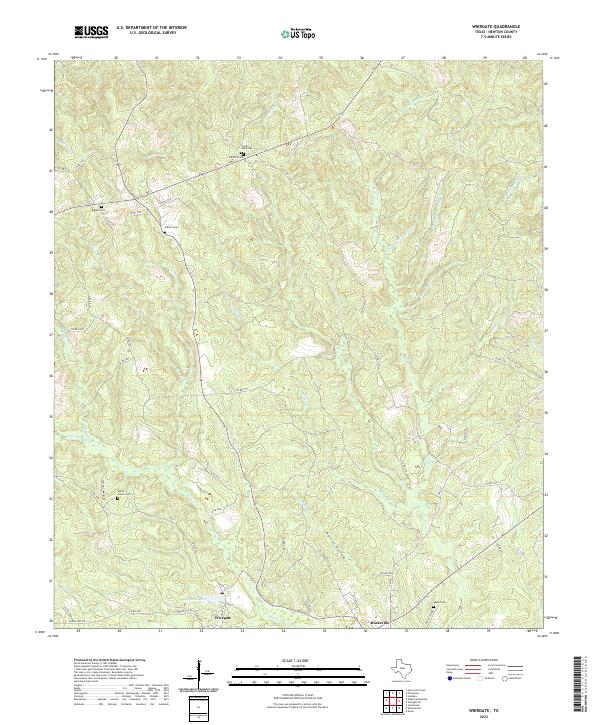
2022 Map of Wiergate
USGS Topo · Published 2022About this map
Wiergate and Burkeville anchor the southern edge of this East Texas terrain, where the landscape is defined by the dense dendritic drainage patterns of Little Cow Cr and its numerous tributaries. The area is characterized by a high concentration of small family and community burial grounds, including Toledo Bend Cem, Mitchell Cem, and the Eddie Gatson Cem located off Gatson Cemetery Rd. These sites, along with others like Rogers Cem and Mattox Cem, offer significant points of interest for genealogical research in Newton County.
Find a feature on this map
62 named features on this map. Tap any name to fly to it.
Don’t see what you’re looking for? This feature index may not catch every label — zoom into the map to look around manually.
Map Details
Editions of this 2022 Wiergate Map
This is the sole edition of this map. No revisions or reprints were ever made.
Other maps of this area

1944 · Wiergate
USGS Topo · 1:62,500

1948 · Wiergate
USGS Topo · 1:62,500

1949 · Evans
USGS Topo · 1:31,680

1952 · Lake Charles
USGS Topo · 1:250,000

1953 · Alexandria
USGS Topo · 1:250,000

1954 · Wiergate
USGS Topo · 1:24,000

1954 · Wiergate SE
USGS Topo · 1:24,000

1954 · Fairdale
USGS Topo · 1:24,000

1954 · Wiergate
USGS Topo · 1:62,500
1954 · Haddens
USGS Topo · 1:24,000