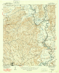
1944 Map of Wiergate
USGS Topo · Published 1949About this map
Sabine National Forest blankets the rugged timberlands of East Texas and Louisiana in this mid-century survey, defined by the winding course of the Sabine River. The landscape reveals a complex network of bayous and sloughs, including Alligator Lake, Horseshoe Lake, and Crossway Slough, which dominate the river's floodplains. Transportation in the early 1940s relied on river crossings like Anthonys Ferry and industrial infrastructure such as the Logging RR and the Wiergate Northern RR, which served the local timber economy.
Find a feature on this map
88 named features on this map. Tap any name to fly to it.
Don’t see what you’re looking for? This feature index may not catch every label — zoom into the map to look around manually.
Map Details
Editions of this 1944 Wiergate Map
2 editions found
Other maps of this area

1941 · Leesville
USGS Topo · 1:62,500

1942 · Florien
USGS Topo · 1:62,500

1943 · Leesville
USGS Topo · 1:62,500

1944 · Negreet
USGS Topo · 1:62,500

1944 · Wiergate
USGS Topo · 1:62,500

1944 · Florien
USGS Topo · 1:62,500

1946 · Leesville
USGS Topo · 1:62,500

1947 · Knight
USGS Topo · 1:31,680

1948 · Leesville
USGS Topo · 1:62,500

1948 · Wiergate
USGS Topo · 1:62,500