
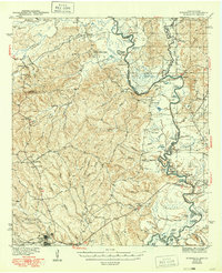
1944 Map of Wiergate
USGS Topo · Published 1944About this map
The Sabine River forms a winding border between Texas and Louisiana, defining a landscape dominated by riparian bottomlands and the timbered uplands of the Sabine National Forest. In the mid-1940s, the economy and community life centered on the Gulf Northern railroad and the lumber town of Wiergate, where local industry met the rail network. Away from the tracks, the terrain is dotted with small rural settlements and institutional landmarks like Toledo, the Mayflower Sch, and Mt Zion Ch.
Find a feature on this map
66 named features on this map. Tap any name to fly to it.
Don’t see what you’re looking for? This feature index may not catch every label — zoom into the map to look around manually.
Map Details
Editions of this 1944 Wiergate Map
2 editions found
Other maps of this area

1941 · Leesville
USGS Topo · 1:62,500

1942 · Florien
USGS Topo · 1:62,500

1943 · Leesville
USGS Topo · 1:62,500

1944 · Negreet
USGS Topo · 1:62,500

1944 · Florien
USGS Topo · 1:62,500

1946 · Leesville
USGS Topo · 1:62,500

1947 · Knight
USGS Topo · 1:31,680

1948 · Leesville
USGS Topo · 1:62,500

1948 · Wiergate
USGS Topo · 1:62,500

1949 · Evans
USGS Topo · 1:31,680