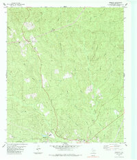
1985 Map of Wiergate
USGS Topo · Published 1985About this map
Wiergate and Burkeville anchor the southern reaches of this East Texas timber and creek-fed landscape as it appeared in the mid-1980s. The region is defined by a dense network of waterways including Little Cow Creek and Bear Branch, where the terrain begins to rise into the piney woods. A significant historical marker is the Old Railroad Grade running through Wiergate, tracing the path of former logging infrastructure that once powered the local economy. Genealogists will find a wealth of local family history through numerous small burial sites such as Rogers Cem, Toledo Cem, and Mattox Cem, often situated near rural congregations like Mt Pleasant Ch or Eddie Gatson Ch. These scattered landmarks, along with a Gravel Pit and various wells, reveal a pattern of rural settlement deeply tied to the land and its resources.
Find a feature on this map
35 named features on this map. Tap any name to fly to it.
Don’t see what you’re looking for? This feature index may not catch every label — zoom into the map to look around manually.
Map Details
Editions of this 1985 Wiergate Map
This is the sole edition of this map. No revisions or reprints were ever made.
Other maps of this area

1944 · Wiergate
USGS Topo · 1:62,500

1948 · Wiergate
USGS Topo · 1:62,500

1949 · Evans
USGS Topo · 1:31,680

1952 · Lake Charles
USGS Topo · 1:250,000

1953 · Alexandria
USGS Topo · 1:250,000

1954 · Wiergate
USGS Topo · 1:24,000

1954 · Wiergate SE
USGS Topo · 1:24,000

1954 · Fairdale
USGS Topo · 1:24,000

1954 · Wiergate
USGS Topo · 1:62,500
1954 · Haddens
USGS Topo · 1:24,000