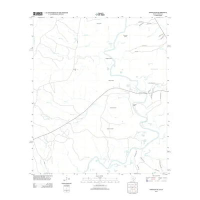
2012 Map of Wiergate SE
USGS Topo · Published 2012About this map
The Sabine River dominates this borderland landscape, winding through a complex system of sloughs, brakes, and oxbow lakes on the edge of Louisiana and Texas. The river’s serpentine path creates distinctive landforms like Scoggins Bend and Russell Bend, which are flanked by low-lying wetlands such as Palmettos Brake and Old Wing Slough. These water features define the local geography, with named bodies like Yellow Lake, Eddie Lake, and Horseshoe Lake scattered across the floodplain.
Find a feature on this map
70 named features on this map. Tap any name to fly to it.
Don’t see what you’re looking for? This feature index may not catch every label — zoom into the map to look around manually.
Map Details
Editions of this 2012 Wiergate SE Map
This is the sole edition of this map. No revisions or reprints were ever made.
Other maps of this area

1941 · Leesville
USGS Topo · 1:62,500

1943 · Leesville
USGS Topo · 1:62,500

1944 · Wiergate
USGS Topo · 1:62,500

1946 · Leesville
USGS Topo · 1:62,500

1947 · Knight
USGS Topo · 1:31,680

1948 · Leesville
USGS Topo · 1:62,500

1948 · Wiergate
USGS Topo · 1:62,500

1949 · Evans
USGS Topo · 1:31,680

1952 · Lake Charles
USGS Topo · 1:250,000

1953 · Alexandria
USGS Topo · 1:250,000