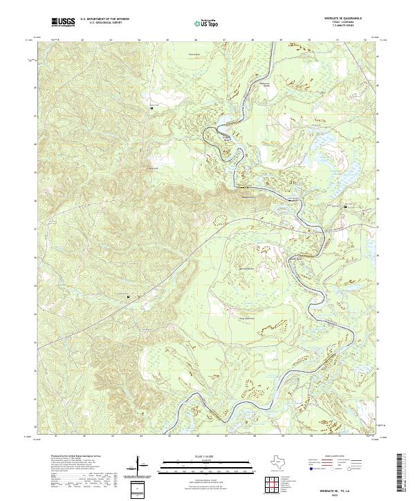
2022 Map of Wiergate SE
USGS Topo · Published 2022About this map
The Sabine River serves as the central artery and natural boundary along the state line in this survey of the river bottomlands. This riparian landscape is defined by its complex hydrography, where the river creates distinctive oxbows and landforms like Scoggins Bend and Russell Bend. The surrounding terrain is a mosaic of seasonal wetlands and elevated hammocks, including Gray Hammock and Dark Hammock, which sit amidst a network of backwater features such as Palmettos Brake and Sibo Brake.
Find a feature on this map
91 named features on this map. Tap any name to fly to it.
Don’t see what you’re looking for? This feature index may not catch every label — zoom into the map to look around manually.
Map Details
Editions of this 2022 Wiergate SE Map
This is the sole edition of this map. No revisions or reprints were ever made.
Other maps of this area

1941 · Leesville
USGS Topo · 1:62,500

1943 · Leesville
USGS Topo · 1:62,500

1944 · Wiergate
USGS Topo · 1:62,500

1946 · Leesville
USGS Topo · 1:62,500

1947 · Knight
USGS Topo · 1:31,680

1948 · Leesville
USGS Topo · 1:62,500

1948 · Wiergate
USGS Topo · 1:62,500

1949 · Evans
USGS Topo · 1:31,680

1952 · Lake Charles
USGS Topo · 1:250,000

1953 · Alexandria
USGS Topo · 1:250,000