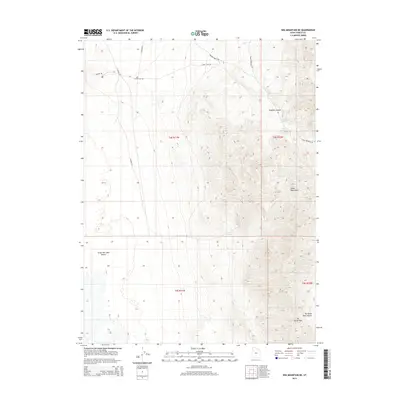
2014 Map of Wig Mountain NE
USGS Topo · Published 2014About this map
The Great Salt Lake Desert dominates the western half of this 2014 survey, where the flat expanse meets the rising elevations of the Cedar Mountains. This arid landscape is defined by the stark transition from the desert floor to rugged drainages like Rydalch Canyon and the notable gateway at Six Horse Pass. Remote water sources such as Browns Spring and Cedar Spring provide rare points of relief in an environment otherwise navigated by a sparse network of desert tracks. These routes, including Sahara Rd and Cedar Flats Rd, follow the natural contours of the mountain foothills and provide the primary access to the deep ravines of Six Horse Pass Canyon. The map illustrates the specialized infrastructure of the Great Basin, where road names like Browns Wash Rd indicate the importance of seasonal drainage features in desert navigation.
Find a feature on this map
17 named features on this map. Tap any name to fly to it.
Don’t see what you’re looking for? This feature index may not catch every label — zoom into the map to look around manually.
Map Details
Editions of this 2014 Wig Mountain NE Map
This is the sole edition of this map. No revisions or reprints were ever made.
Other maps of this area

1885 · Tooele Valley
USGS Topo · 1:250,000

1953 · Tooele
USGS Topo · 1:250,000

1954 · Wig Mtn SW
USGS Topo · 1:24,000

1954 · Wig Mtn NW
USGS Topo · 1:24,000

1955 · Tabbys Peak
USGS Topo · 1:24,000

1955 · Wig Mtn
USGS Topo · 1:24,000

1955 · Wig Mtn NE
USGS Topo · 1:24,000

1955 · Tabbys Peak SW
USGS Topo · 1:24,000

1955 · Tooele
USGS Topo · 1:250,000

1973 · Quincy Spring
USGS Topo · 1:24,000