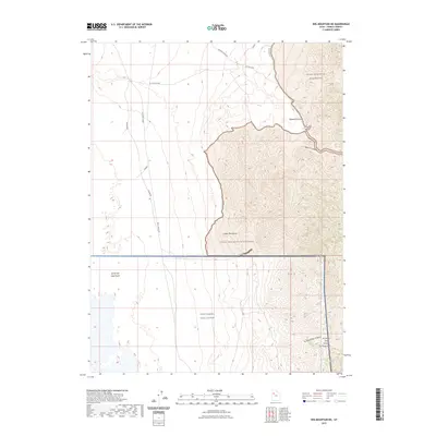
2023 Map of Wig Mountain NE
USGS Topo · Published 2023About this map
The Cedar Mountain Wilderness dominates the eastern half of this terrain, where steep ridges give way to the expansive flats of the Great Salt Lake Desert to the west. This 2023 edition documents a stark transition between the protected mountainous landscape and the military boundaries of the West Desert Test Center. Significant transportation routes including the historic Lincoln Hwy, Skull Valley Rd, and Sahara Rd skirt the base of the Cedar Mountains, tracing the edge of the desert floor. Remote water sources like Browns Spring and Cedar Spring are vital markers in this arid environment, while deep incisions such as Rydalch Canyon and Six Horse Pass Canyon define the drainage patterns of the range.
Find a feature on this map
13 named features on this map. Tap any name to fly to it.
Don’t see what you’re looking for? This feature index may not catch every label — zoom into the map to look around manually.
Map Details
Editions of this 2023 Wig Mountain NE Map
This is the sole edition of this map. No revisions or reprints were ever made.
Other maps of this area

1885 · Tooele Valley
USGS Topo · 1:250,000

1953 · Tooele
USGS Topo · 1:250,000

1954 · Wig Mtn SW
USGS Topo · 1:24,000

1954 · Wig Mtn NW
USGS Topo · 1:24,000

1955 · Tabbys Peak
USGS Topo · 1:24,000

1955 · Wig Mtn
USGS Topo · 1:24,000

1955 · Wig Mtn NE
USGS Topo · 1:24,000

1955 · Tabbys Peak SW
USGS Topo · 1:24,000

1955 · Tooele
USGS Topo · 1:250,000

1973 · Quincy Spring
USGS Topo · 1:24,000