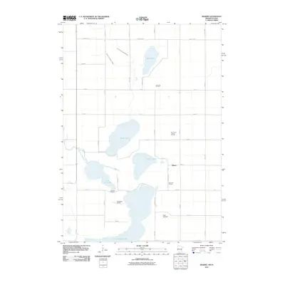
2010 Map of Wilbert
USGS Topo · Published 2010About this map
Glacial lakes and agricultural plots define the landscape of Martin County along the Minnesota-Iowa border. The small settlement of Wilbert serves as a local landmark amidst a chain of water bodies, including Bright Lake, Clayton Lake, and Little Tuttle Lake, which lead toward the southern border at Okamanpeedan Lake. This region reflects a deeply rooted rural community, marked by several family and congregational burial grounds such as Half Moon Cemetery, Saint Paul's Lutheran Cemetery, and Teitje Farm Cemetery.
Find a feature on this map
38 named features on this map. Tap any name to fly to it.
Don’t see what you’re looking for? This feature index may not catch every label — zoom into the map to look around manually.
Map Details
Editions of this 2010 Wilbert Map
This is the sole edition of this map. No revisions or reprints were ever made.
Other maps of this area

1954 · Fairmont
USGS Topo · 1:250,000

1958 · Fairmont
USGS Topo · 1:250,000

1967 · Wilmert Lake
USGS Topo · 1:24,000

1967 · Fairmont
USGS Topo · 1:24,000

1970 · Ceylon
USGS Topo · 1:24,000

1970 · Welcome
USGS Topo · 1:24,000

1970 · Wilbert
USGS Topo · 1:24,000

1970 · Sherburn
USGS Topo · 1:24,000

1980 · Armstrong
USGS Topo · 1:24,000

1980 · Gruver
USGS Topo · 1:24,000