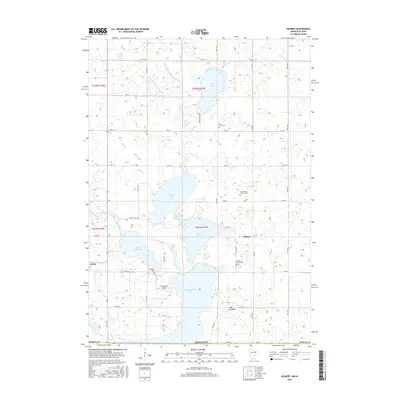
2016 Map of Wilbert
USGS Topo · Published 2016About this map
Okamanpeedan Lake and its surrounding wetlands dominate this landscape along the border of Martin County, where agricultural grid roads intersect a complex chain of glacial water bodies. The settlement of Wilbert stands as a central landmark, supported by local institutions like Saint Paul's Lutheran Cem. To the west, Ceylon marks the edge of a region defined by managed water systems, including County Ditch Number Fiftyseven and Judicial Ditch Number Thirty-six. These engineering efforts demonstrate the 21st-century's continued commitment to land reclamation in the prairie pothole region. For genealogists and local historians, several family-named and community landmarks are visible, such as Teltje Farm Cem, Tenhassen Cem, and the Rosenberg Airport, providing a detailed look at the rural social and economic infrastructure near the East Fork Des Moines River.
Find a feature on this map
39 named features on this map. Tap any name to fly to it.
Don’t see what you’re looking for? This feature index may not catch every label — zoom into the map to look around manually.
Map Details
Editions of this 2016 Wilbert Map
This is the sole edition of this map. No revisions or reprints were ever made.
Other maps of this area

1954 · Fairmont
USGS Topo · 1:250,000

1958 · Fairmont
USGS Topo · 1:250,000

1967 · Wilmert Lake
USGS Topo · 1:24,000

1967 · Fairmont
USGS Topo · 1:24,000

1970 · Ceylon
USGS Topo · 1:24,000

1970 · Welcome
USGS Topo · 1:24,000

1970 · Wilbert
USGS Topo · 1:24,000

1970 · Sherburn
USGS Topo · 1:24,000

1980 · Armstrong
USGS Topo · 1:24,000

1980 · Gruver
USGS Topo · 1:24,000