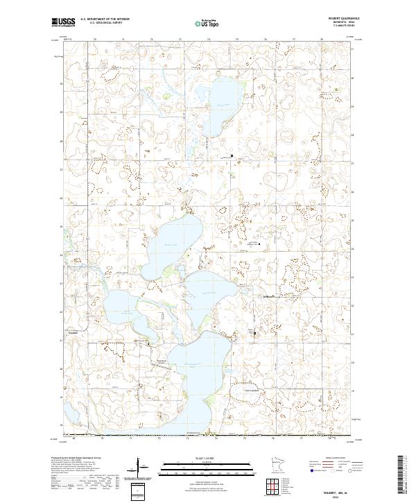
2022 Map of Wilbert
USGS Topo · Published 2022About this map
Wilbert and the surrounding Martin County agricultural landscape are defined by a complex network of glacial lakes and drainage systems near the Iowa border. The terrain is notably interrupted by Little Tuttle Lake and Okamanpeedan Lake, while the East Fork Des Moines River winds through the western section near Ceylon. This area preserves several localized burial sites that speak to the region's pioneer heritage, including the Teitje Farm Cem and Ten Hassen Cem. An interesting geographical feature is the Clear Lakebed, suggesting changes in the local hydrology over time. Managed waterways like County Ditch Number Fiftyseven and Judicial Ditch Number Thirtysix crisscross the section lines, illustrating the extensive engineering required to maintain the productivity of this prairie farmland. Rosenberg Airport serves as a small aviation landmark amidst the rural grid of township roads.
Find a feature on this map
41 named features on this map. Tap any name to fly to it.
Don’t see what you’re looking for? This feature index may not catch every label — zoom into the map to look around manually.
Map Details
Editions of this 2022 Wilbert Map
This is the sole edition of this map. No revisions or reprints were ever made.
Other maps of this area

1954 · Fairmont
USGS Topo · 1:250,000

1958 · Fairmont
USGS Topo · 1:250,000

1967 · Wilmert Lake
USGS Topo · 1:24,000

1967 · Fairmont
USGS Topo · 1:24,000

1970 · Ceylon
USGS Topo · 1:24,000

1970 · Welcome
USGS Topo · 1:24,000

1970 · Wilbert
USGS Topo · 1:24,000

1970 · Sherburn
USGS Topo · 1:24,000

1980 · Armstrong
USGS Topo · 1:24,000

1980 · Gruver
USGS Topo · 1:24,000