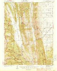
1944 Map of Wilbur Springs
USGS Topo · Published 1944About this map
The quicksilver mining district near Wilbur Springs defines the character of this mid-century landscape along the Colusa Co Lake Co border. The concentration of mineral operations at the southern end of the sheet, including the Abbott Mine, Mercury Mine, and Wide Awake Mine, highlights a period of intense industrial activity in the Inner Coast Ranges. Settlement patterns are sparse and focused around transit points and resource hubs, notably at the small community of Leesville and the Mountain House junction.
Find a feature on this map
53 named features on this map. Tap any name to fly to it.
Don’t see what you’re looking for? This feature index may not catch every label — zoom into the map to look around manually.
Map Details
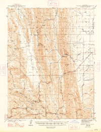
Editions of this 1944 Wilbur Springs Map
3 editions found

Other maps of this area

1904 · Sites
USGS Topo · 1:24,000

1905 · Fairview
USGS Topo · 1:24,000

1906 · Maxwell
USGS Topo · 1:62,500

1907 · Colusa
USGS Topo · 1:62,500

1917 · Sites
USGS Topo · 1:31,680

1917 · Delevan
USGS Topo · 1:31,680

1918 · Williams
USGS Topo · 1:31,680

1918 · Spring Valley
USGS Topo · 1:31,680

1920 · Venado
USGS Topo · 1:62,500

1924 · Bartlett Springs
USGS Topo · 1:62,500