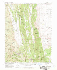
1961 Map of Wilbur Springs
USGS Topo · Published 1970About this map
Wilbur Springs serves as a focal point in this landscape where the Colusa and Lake county lines meet along County Line Ridge. The area is characterized by a concentrated mining history in the south, where researchers can identify the sites of the Empire Mine, Central Mine, Wide Awake Mine, and Turkey Run Mine clustered near Sulphur Creek. These workings, alongside the Clyde Mine to the north, point to the mineral-driven economy that once defined these hills.
Find a feature on this map
103 named features on this map. Tap any name to fly to it.
Don’t see what you’re looking for? This feature index may not catch every label — zoom into the map to look around manually.
Map Details
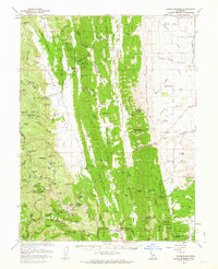
Editions of this 1961 Wilbur Springs Map
2 editions found
Other maps of this area

1904 · Sites
USGS Topo · 1:24,000

1905 · Fairview
USGS Topo · 1:24,000

1906 · Maxwell
USGS Topo · 1:62,500

1907 · Colusa
USGS Topo · 1:62,500

1917 · Sites
USGS Topo · 1:31,680

1917 · Delevan
USGS Topo · 1:31,680

1918 · Williams
USGS Topo · 1:31,680

1918 · Spring Valley
USGS Topo · 1:31,680

1920 · Venado
USGS Topo · 1:62,500

1924 · Bartlett Springs
USGS Topo · 1:62,500