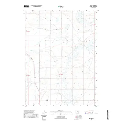
2017 Map of Wilcox
USGS Topo · Published 2017About this map
Rock River and the settlement of Wilcox anchor this Albany County landscape, illustrating a high-plains environment defined by early twentieth-century water management. The course of Rock Creek meanders across the eastern half of the map, supporting an intricate system of irrigation infrastructure essential for regional agriculture. Engineered waterways like Taylor Ditch, Bosler Ditch Number 3, Johnson Ditch, and Bluff Ditch intersect the terrain, tracing the efforts of early settlers to divert water across the arid basins. Transport and access are provided by local thoroughfares such as Co Rd 67, Banzhaf Ln, and Thornton Ln, which connect the scattered homesteads and ranching tracts. Smaller drainage features, including Meiser Cr, feed into the larger creek system, highlighting the natural topography that dictated the placement of these vital irrigation networks.
Find a feature on this map
18 named features on this map. Tap any name to fly to it.
Don’t see what you’re looking for? This feature index may not catch every label — zoom into the map to look around manually.
Map Details
Editions of this 2017 Wilcox Map
This is the sole edition of this map. No revisions or reprints were ever made.
Other maps of this area

1915 · Como Ridge
USGS Topo · 1:48,000

1918 · Como Ridge
USGS Topo · 1:62,500

1954 · Cheyenne
USGS Topo · 1:250,000

1954 · Rawlins
USGS Topo · 1:250,000

1955 · Pine Tree Ridge
USGS Topo · 1:24,000

1955 · Sevenmile Spring
USGS Topo · 1:24,000

1955 · Cooper Lake North
USGS Topo · 1:24,000

1955 · Rock River
USGS Topo · 1:24,000

1955 · Cannonball Cut
USGS Topo · 1:24,000

1955 · Wilcox
USGS Topo · 1:24,000