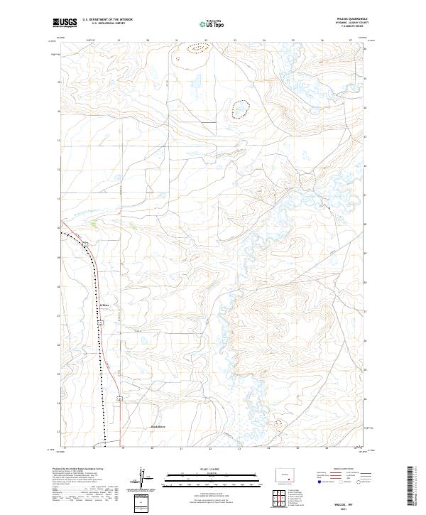
2021 Map of Wilcox
USGS Topo · Published 2021About this map
Wilcox and the northern outskirts of Rock River anchor this topographic view of the Wyoming high plains in Albany County. The landscape is defined by an extensive network of water management, where numerous irrigation channels such as Johnston Ditch, Bluff Ditch, and Bosler Ditch Number 3 divert water across the flats. These man-made waterways crisscross the natural drainage of Rock Creek and Meiser Cr, illustrating the area's deep-rooted reliance on water rights and ranching infrastructure. Rural roads like Banzhaf Ln and Thornton Ln provide access to the dispersed holdings within the township and range grid. This study captures the intersection of natural hydrology and engineering, preserving the layout of the high-desert prairie as it functions today.
Find a feature on this map
18 named features on this map. Tap any name to fly to it.
Don’t see what you’re looking for? This feature index may not catch every label — zoom into the map to look around manually.
Map Details
Editions of this 2021 Wilcox Map
This is the sole edition of this map. No revisions or reprints were ever made.
Other maps of this area

1915 · Como Ridge
USGS Topo · 1:48,000

1918 · Como Ridge
USGS Topo · 1:62,500

1954 · Cheyenne
USGS Topo · 1:250,000

1954 · Rawlins
USGS Topo · 1:250,000

1955 · Pine Tree Ridge
USGS Topo · 1:24,000

1955 · Sevenmile Spring
USGS Topo · 1:24,000

1955 · Cooper Lake North
USGS Topo · 1:24,000

1955 · Rock River
USGS Topo · 1:24,000

1955 · Cannonball Cut
USGS Topo · 1:24,000

1955 · Wilcox
USGS Topo · 1:24,000