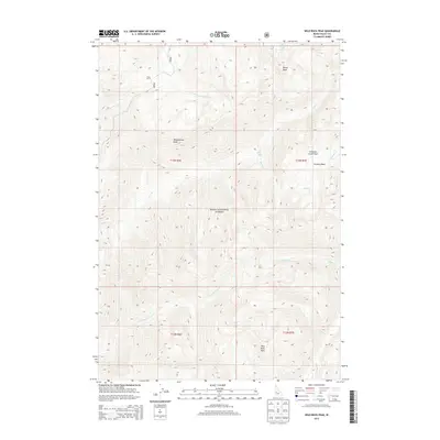
2013 Map of Wild Buck Peak
USGS Topo · Published 2013About this map
Wild Buck Peak and the high ridges of the Boise National Forest dominate this terrain in central Idaho. The landscape is defined by its drainage systems, where the S Fork Salmon River and Wild Buck Cr carve through steep topography near summits like Monumental Peak and Rocky Peak. This 2013 survey illustrates the remote character of the region, showing the solitary Cupp Corral and the winding Stratton Creek Trail as primary markers of human presence in a wilderness dominated by basins and creeks. The water network is intricate, featuring high-elevation points like Long Lake and the convergence of multiple forks, including Long Fork Silver Cr and Oxtail Cr. These features reflect a legacy of land management and recreational use in the rugged Salmon River watershed.
Find a feature on this map
22 named features on this map. Tap any name to fly to it.
Don’t see what you’re looking for? This feature index may not catch every label — zoom into the map to look around manually.
Map Details
Editions of this 2013 Wild Buck Peak Map
This is the sole edition of this map. No revisions or reprints were ever made.
Other maps of this area

1909 · Garden Valley
USGS Topo · 1:125,000

1953 · Boiling Springs
USGS Topo · 1:62,500

1953 · Deadwood Reservoir
USGS Topo · 1:62,500

1954 · Gold Fork
USGS Topo · 1:62,500

1954 · Warm Lake
USGS Topo · 1:62,500

1957 · Challis
USGS Topo · 1:250,000

1960 · Challis
USGS Topo · 1:250,000

1963 · Challis
USGS Topo · 1:250,000

1982 · Pistol Creek
USGS Topo · 1:100,000

1982 · Deadwood River
USGS Topo · 1:100,000