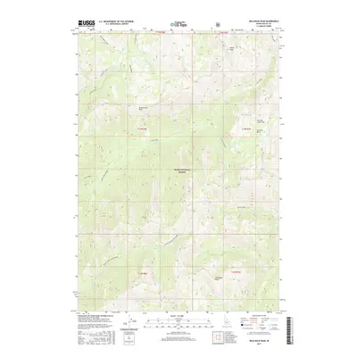
2017 Map of Wild Buck Peak
USGS Topo · Published 2017About this map
Wild Buck Peak and the high ridges of the Boise National Forest dominate this high-altitude landscape in central Idaho. The terrain is defined by a series of prominent summits, including Rocky Peak in the north and Monumental Peak further south, which overlook a complex drainage system feeding the S Fork Salmon River. The map documents a rugged interior accessible by established paths like the Stratton Creek Trail and the curiously named Cup Corral Cutoff, illustrating how modern forest management maintains traditional routes through the backcountry. Notable water features such as Long Lake and the Stratton Basin area sit among the headwaters of numerous creeks, including Sixteen-to-one Cr and Bull Creek. This 2017 survey reflects the contemporary topography and hydrography of the Salmon River Mountains, detailing the numerous drainages like Bitter Creek and Goat Cr that carve the steep slopes of the Boise National Forest.
Find a feature on this map
28 named features on this map. Tap any name to fly to it.
Don’t see what you’re looking for? This feature index may not catch every label — zoom into the map to look around manually.
Map Details
Editions of this 2017 Wild Buck Peak Map
This is the sole edition of this map. No revisions or reprints were ever made.
Other maps of this area

1909 · Garden Valley
USGS Topo · 1:125,000

1953 · Boiling Springs
USGS Topo · 1:62,500

1953 · Deadwood Reservoir
USGS Topo · 1:62,500

1954 · Gold Fork
USGS Topo · 1:62,500

1954 · Warm Lake
USGS Topo · 1:62,500

1957 · Challis
USGS Topo · 1:250,000

1960 · Challis
USGS Topo · 1:250,000

1963 · Challis
USGS Topo · 1:250,000

1982 · Pistol Creek
USGS Topo · 1:100,000

1982 · Deadwood River
USGS Topo · 1:100,000