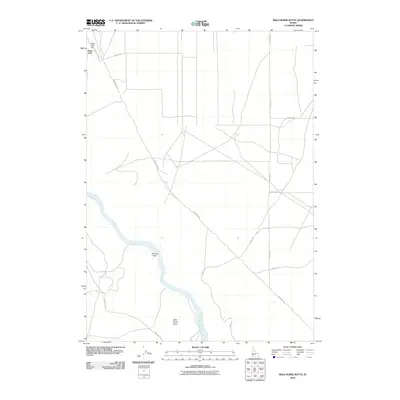
2010 Map of Wild Horse Butte
USGS Topo · Published 2010About this map
Snake River canyon walls and the high desert plateaus of Ada County define this landscape as it appeared in the early 21st century. The Swan Falls Dam stands as a primary landmark in the northwest corner, a site representing over a century of hydroelectric power generation on this stretch of the river. The map documents a transition between the rugged river corridor at Thomas Flats and the expansive volcanic plains to the east, where a network of straight-line section roads like Abendroth Rd and Leighton Rd divide the land. Of particular interest to historians is the preservation of the Emigrant Tr, which skirts the southern base of Wild Horse Butte, marking the enduring physical legacy of the Oregon Trail's south alternate route through the Idaho desert.
Find a feature on this map
14 named features on this map. Tap any name to fly to it.
Don’t see what you’re looking for? This feature index may not catch every label — zoom into the map to look around manually.
Map Details
Editions of this 2010 Wild Horse Butte Map
This is the sole edition of this map. No revisions or reprints were ever made.
Other maps of this area

1892 · Bisuka
USGS Topo · 1:125,000

1894 · Bisuka
USGS Topo · 1:125,000

1947 · Jackass Butte
USGS Topo · 1:24,000

1947 · Wild Horse Butte
USGS Topo · 1:24,000

1948 · Castle Butte
USGS Topo · 1:24,000

1948 · Big Foot Butte
USGS Topo · 1:24,000

1948 · Wild Horse Butte
USGS Topo · 1:24,000

1948 · Jackass Butte
USGS Topo · 1:24,000

1948 · Big Foot Butte
USGS Topo · 1:62,500

1948 · Sinker Butte
USGS Topo · 1:24,000