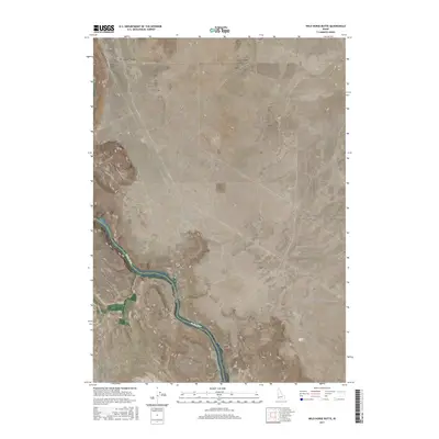
2017 Map of Wild Horse Butte
USGS Topo · Published 2017About this map
Snake River canyon walls dominate this portion of the Idaho landscape where Ada and Owyhee counties meet. The high plateau above the river is marked by the distinctive Wild Horse Butte and the historic route of the Emigrant Trl, which winds through the southern terrain toward the river's edge. This 2017 survey by the U.S. Geological Survey illustrates a sparsely populated region defined by agricultural water access and topographic elevation changes, with Thomas Flats serving as a localized point of interest near the water. Modern infrastructure such as S Swan Falls Rd and Moore Rd provide access across the section lines of the Public Land Survey System, highlighting the ongoing human footprint on this high desert terrain.
Find a feature on this map
11 named features on this map. Tap any name to fly to it.
Don’t see what you’re looking for? This feature index may not catch every label — zoom into the map to look around manually.
Map Details
Editions of this 2017 Wild Horse Butte Map
This is the sole edition of this map. No revisions or reprints were ever made.
Other maps of this area

1892 · Bisuka
USGS Topo · 1:125,000

1894 · Bisuka
USGS Topo · 1:125,000

1947 · Jackass Butte
USGS Topo · 1:24,000

1947 · Wild Horse Butte
USGS Topo · 1:24,000

1948 · Castle Butte
USGS Topo · 1:24,000

1948 · Big Foot Butte
USGS Topo · 1:24,000

1948 · Wild Horse Butte
USGS Topo · 1:24,000

1948 · Jackass Butte
USGS Topo · 1:24,000

1948 · Big Foot Butte
USGS Topo · 1:62,500

1948 · Sinker Butte
USGS Topo · 1:24,000