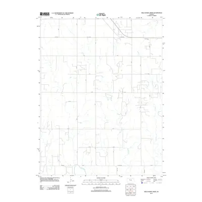
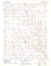
2012 Map of Wild Horse Creek
USGS Topo · Published 2012About this map
The agricultural grid of Rooks County dominates this landscape, where sections of farmland are bisected by a network of local roads such as Red Line Road and EE Road. The hydrology is defined by the winding course of Spring Cr in the northern portion of the quadrangle, alongside several unnamed drainages that feed into the larger river systems of the Kansas plains. This survey reflects the modern rural character of the region, emphasizing the strictly organized land use and the transition between upland prairie and the riparian zones that follow the natural contours of the local creek beds.
Find a feature on this map
1 named feature on this map. Tap any name to fly to it.
Don’t see what you’re looking for? This feature index may not catch every label — zoom into the map to look around manually.
Map Details
Editions of this 2012 Wild Horse Creek Map
This is the sole edition of this map. No revisions or reprints were ever made.
Other maps of this area

1893 · Hill
USGS Topo · 1:125,000

1896 · Plainville
USGS Topo · 1:125,000

1955 · Beloit
USGS Topo · 1:250,000

1959 · Beloit
USGS Topo · 1:250,000
1963 · Hill City 4 SE
USGS Topo · 1:24,000
1963 · Hill City 4 SW
USGS Topo · 1:24,000

1969 · Palco
USGS Topo · 1:24,000

1969 · Stockton SW
USGS Topo · 1:24,000
1978 · Plainville SW
USGS Topo · 1:24,000
1978 · Zurich
USGS Topo · 1:24,000