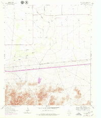
1964 Map of Wild Horse
USGS Topo · Published 1979About this map
The Wylie Mountains dominate the southern landscape of this West Texas survey, where the arid terrain is defined by ranching life and a critical transportation corridor. In the early 1960s, the lowlands are drained by Wild Horse Draw, a seasonal watercourse that parallels the heavy infrastructure of the Missouri Pacific railroad. Human presence is concentrated at remote outposts like Durrill Camp and Harper Ranch, which represent the survival of isolated livestock operations in the high desert.
Find a feature on this map
9 named features on this map. Tap any name to fly to it.
Don’t see what you’re looking for? This feature index may not catch every label — zoom into the map to look around manually.
Map Details
Editions of this 1964 Wild Horse Map
2 editions found
Other maps of this area

1892 · Chispa
USGS Topo · 1:125,000

1895 · Chispa
USGS Topo · 1:125,000

1897 · Chispa
USGS Topo · 1:125,000

1906 · Van Horn
USGS Topo · 1:125,000

1954 · Van Horn
USGS Topo · 1:250,000

1958 · Van Horn
USGS Topo · 1:250,000

1959 · Marfa
USGS Topo · 1:250,000
1964 · Goat Canyon
USGS Topo · 1:24,000

1964 · Wild Horse
USGS Topo · 1:24,000

1964 · Watson Ranch
USGS Topo · 1:24,000