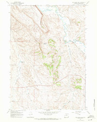
1967 Map of Wild Horse Hill
USGS Topo · Published 1971About this map
Nowood River meanders through this portion of Washakie County, defining a landscape shaped by water management and mineral exploration during the late 1960s. The map illustrates a complex network of irrigation, including the West Ditch and the Victoria Winsor Ditch, which supported ranching in the valleys of Brokenback Creek and Big Cottonwood Creek. Evidence of the era's energy industry is found at the Occidental Well (Flowing) and a scattered Drill Hole in the higher elevations.
Find a feature on this map
13 named features on this map. Tap any name to fly to it.
Don’t see what you’re looking for? This feature index may not catch every label — zoom into the map to look around manually.
Map Details
Editions of this 1967 Wild Horse Hill Map
2 editions found
Other maps of this area

1899 · Cloud peak
USGS Topo · 1:125,000

1901 · Cloud Peak
USGS Topo · 1:125,000

1955 · Sheridan
USGS Topo · 1:250,000

1955 · Arminto
USGS Topo · 1:250,000

1958 · Sheridan
USGS Topo · 1:250,000

1958 · Arminto
USGS Topo · 1:250,000

1962 · Sheridan
USGS Topo · 1:250,000

1962 · Arminto
USGS Topo · 1:250,000

1966 · Cabin Fork
USGS Topo · 1:24,000
1966 · Joe Emge Creek
USGS Topo · 1:24,000