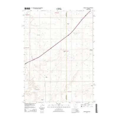
2015 Map of Wildcat Butte
USGS Topo · Published 2015About this map
Wildcat Butte anchors this landscape in southwest Wyoming, situated along the county line where Uinta and Sweetwater Counties meet. This arid stretch of terrain is defined by a complex network of seasonal drainages and water sources, including the life-giving waters of Meadow Springs and Garter Spring. The topography is etched with numerous named features such as Caterpillar Draw, Blumel Draw, and the southern Jackknife Draw, reflecting the local nomenclature of the high desert. The primary corridor through this open country is Church Butte Rd, which navigates a land shaped by deep history and sparse human settlement. The map provides a clear look at the intersection of several townships, from t18n r113w down to t16n r112w, showing the surveyed grid laid over the natural basins of Porter Hollow and Chicken Draw.
Find a feature on this map
17 named features on this map. Tap any name to fly to it.
Don’t see what you’re looking for? This feature index may not catch every label — zoom into the map to look around manually.
Map Details
Editions of this 2015 Wildcat Butte Map
This is the sole edition of this map. No revisions or reprints were ever made.
Other maps of this area

1954 · Ogden
USGS Topo · 1:250,000

1954 · Rock Springs
USGS Topo · 1:250,000

1958 · Ogden
USGS Topo · 1:250,000

1958 · Rock Springs
USGS Topo · 1:250,000

1960 · Ogden
USGS Topo · 1:250,000

1961 · Granger
USGS Topo · 1:24,000

1962 · Rock Springs
USGS Topo · 1:250,000

1964 · Butcher Knife Draw
USGS Topo · 1:24,000

1964 · Antelope Knoll
USGS Topo · 1:24,000
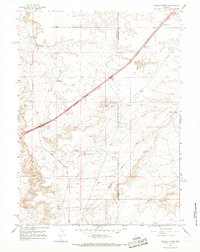
1964 · Wildcat Butte
USGS Topo · 1:24,000