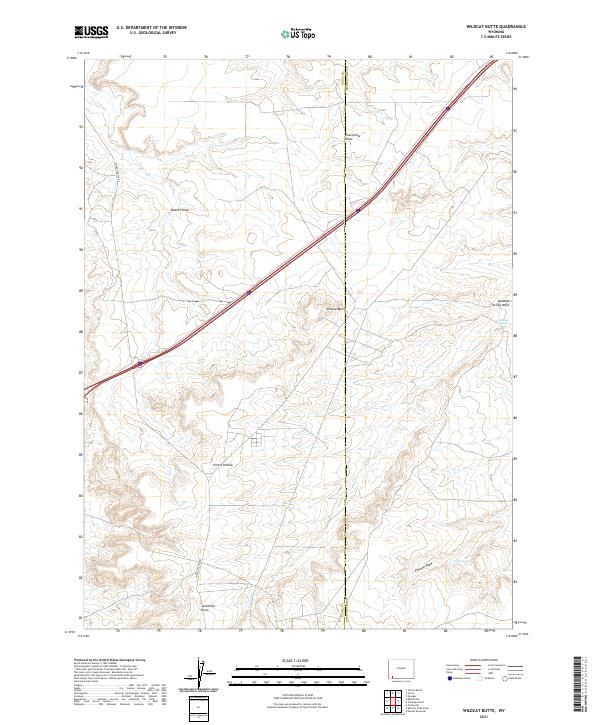
2021 Map of Wildcat Butte
USGS Topo · Published 2021About this map
The high plains of southwestern Wyoming are defined here by the prominent Wildcat Butte, where the border between Uinta County and Sweetwater County meets. This 2021 topographic record reveals an arid landscape carved by seasonal drainages and essential water sources, such as Meadow Springs and Carter Spring. The geography is shaped by a series of named gullies and hollows, including Caterpillar Draw and Porter Hollow, which illustrate the complex drainage patterns feeding into Meadow Springs Wash. Transportation through this corner of the state is anchored by the corridor of Church Butte Rd, which navigates the undulating terrain between the different townships of the Public Land Survey System. The map provides a look at the modern land use in a region historically characterized by open range and nomadic ranching, where features like Blumel Draw and Jackknife Draw remain key landmarks for navigation and land management.
Find a feature on this map
17 named features on this map. Tap any name to fly to it.
Don’t see what you’re looking for? This feature index may not catch every label — zoom into the map to look around manually.
Map Details
Editions of this 2021 Wildcat Butte Map
This is the sole edition of this map. No revisions or reprints were ever made.
Other maps of this area

1954 · Ogden
USGS Topo · 1:250,000

1954 · Rock Springs
USGS Topo · 1:250,000

1958 · Ogden
USGS Topo · 1:250,000

1958 · Rock Springs
USGS Topo · 1:250,000

1960 · Ogden
USGS Topo · 1:250,000

1961 · Granger
USGS Topo · 1:24,000

1962 · Rock Springs
USGS Topo · 1:250,000

1964 · Butcher Knife Draw
USGS Topo · 1:24,000

1964 · Antelope Knoll
USGS Topo · 1:24,000
1964 · Wildcat Butte
USGS Topo · 1:24,000