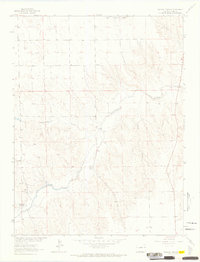
1963 Map of Wildcat Canyon
USGS Topo · Published 1965About this map
Arikaree River bottomlands define this portion of Yuma County, where the watercourse carves a wide path through the High Plains. This 1963 field survey captures a landscape of cattle ranching and sparse water resources, centered on the confluence of several intermittent drainages. Local landmarks such as McCoy Ranch, Mulliri Ranch, and Gerberzs provide specific points of interest for genealogists tracing family landholdings in this part of eastern Colorado. The terrain is deeply incised by Wildcat Canyon and several feeder streams, including Copperkettle Creek and Black Wolf Creek. This survey was conducted as part of the Department of the Interior's Missouri River Basin development program, documenting the rural topography before later changes in land use or infrastructure altered the drainage patterns near Hay Spring Gulch.
Find a feature on this map
11 named features on this map. Tap any name to fly to it.
Don’t see what you’re looking for? This feature index may not catch every label — zoom into the map to look around manually.
Map Details
Editions of this 1963 Wildcat Canyon Map
2 editions found
Other maps of this area

1950 · Bonny Reservoir
USGS Topo · 1:62,500

1954 · Limon
USGS Topo · 1:250,000

1957 · Limon
USGS Topo · 1:250,000

1958 · Limon
USGS Topo · 1:250,000

1963 · Vernon
USGS Topo · 1:24,000

1963 · Beecher Island
USGS Topo · 1:24,000

1963 · Beecher Island NW
USGS Topo · 1:24,000

1963 · Wildcat Canyon
USGS Topo · 1:24,000

1968 · Vernon SW
USGS Topo · 1:24,000

1968 · Bonny Reservoir North
USGS Topo · 1:24,000