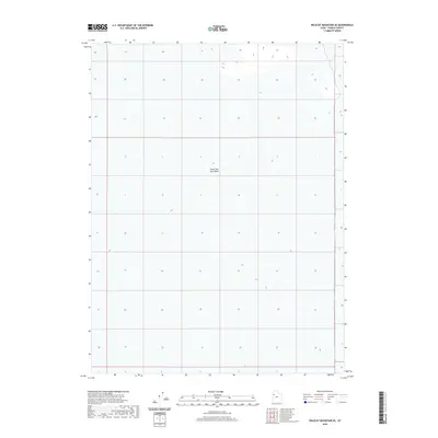
2020 Map of Wildcat Mountain SE
USGS Topo · Published 2020About this map
Great Salt Lake Desert dominates the landscape of this Tooele County quadrangle, revealing a vast, flat expanse where land and water history merge. This survey reflects the modern geospatial mapping of one of the most desolate regions in Utah, highlighting the minimal topographic relief through subtle contouring. The lack of settlements or man-made infrastructure on this specific sheet emphasizes the extreme environment of the western desert during the early twenty-first century. Researchers interested in the natural history and geological boundaries of the basin will find the precise UTM grid and Public Land Survey System data essential for navigating this remote sector of the alkali flats.
Find a feature on this map
1 named feature on this map. Tap any name to fly to it.
Don’t see what you’re looking for? This feature index may not catch every label — zoom into the map to look around manually.
Map Details
Editions of this 2020 Wildcat Mountain SE Map
This is the sole edition of this map. No revisions or reprints were ever made.
Other maps of this area

1953 · Tooele
USGS Topo · 1:250,000

1954 · Wig Mtn SW
USGS Topo · 1:24,000

1954 · Wildcat Mtn
USGS Topo · 1:24,000

1954 · Granite Peak
USGS Topo · 1:24,000

1954 · Wildcat Mtn SE
USGS Topo · 1:24,000

1954 · Dugway Proving Ground NW
USGS Topo · 1:24,000

1954 · Wig Mtn NW
USGS Topo · 1:24,000

1955 · Tooele
USGS Topo · 1:250,000

1973 · Wildcat Mountain SW
USGS Topo · 1:24,000

1973 · Wildcat Mountain NW
USGS Topo · 1:24,000