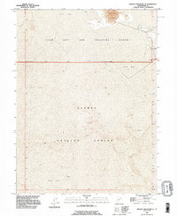
1993 Map of Wildcat Mountain SE
USGS Topo · Published 1996About this map
The Utah Test and Training Range and Dugway Proving Ground dominate this mid-century desert landscape, illustrating the significant military presence in the Great Salt Lake Desert. Compiled from imagery dating back to 1953 and updated in the early 1990s, the map reveals a stark terrain defined by expansive Mud Flats and shifting Sand Dunes. The absence of civilian infrastructure emphasizes the area's specialized role in national defense, where the topography itself serves as a buffer for testing and training operations. The precise delineation of township boundaries, including T 5 S T 6 S, provides a foundational grid for the vast stretches of uninhabited land within Tooele County.
Find a feature on this map
8 named features on this map. Tap any name to fly to it.
Don’t see what you’re looking for? This feature index may not catch every label — zoom into the map to look around manually.
Map Details
Editions of this 1993 Wildcat Mountain SE Map
This is the sole edition of this map. No revisions or reprints were ever made.
Other maps of this area

1953 · Tooele
USGS Topo · 1:250,000

1954 · Wig Mtn SW
USGS Topo · 1:24,000

1954 · Wildcat Mtn
USGS Topo · 1:24,000

1954 · Granite Peak
USGS Topo · 1:24,000

1954 · Wildcat Mtn SE
USGS Topo · 1:24,000

1954 · Dugway Proving Ground NW
USGS Topo · 1:24,000

1954 · Wig Mtn NW
USGS Topo · 1:24,000

1955 · Tooele
USGS Topo · 1:250,000

1973 · Wildcat Mountain SW
USGS Topo · 1:24,000

1973 · Wildcat Mountain NW
USGS Topo · 1:24,000