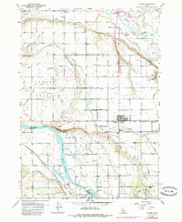
1957 Map of Wilder
USGS Topo · Published 1985About this map
The Snake River and Boise River converge in this fertile corner of Canyon County, defining a landscape transformed by early twentieth-century irrigation engineering. Small agricultural centers like Wilder, Roswell, and Allendale are linked by the Union Pacific Railroad, which mirrors the complex network of canals and drains that support the region's farms. Notable landmarks including the Labor Camp and several rural burying grounds, such as Wilder Cemetery and Fargo Cemetery, provide specific touchstones for local history and genealogy. The terrain in Arena Valley is meticulously detailed with siphons, flumes, and numbered laterals, illustrating the density of water management infrastructure. Near the riverbanks, features like Goat Island and Gravelly Point mark the original natural landmarks of the waterway before the intensive development of the surrounding high desert into productive acreage.
Find a feature on this map
70 named features on this map. Tap any name to fly to it.
Don’t see what you’re looking for? This feature index may not catch every label — zoom into the map to look around manually.
Map Details
Editions of this 1957 Wilder Map
3 editions found
Other maps of this area

1898 · Nampa
USGS Topo · 1:125,000

1906 · Mitchell Butte
USGS Topo · 1:125,000

1955 · Boise
USGS Topo · 1:250,000

1957 · Wilder
USGS Topo · 1:24,000

1957 · Notus
USGS Topo · 1:24,000

1958 · Boise
USGS Topo · 1:250,000

1958 · Homedale
USGS Topo · 1:24,000
1958 · Marsing
USGS Topo · 1:24,000

1962 · Boise
USGS Topo · 1:250,000
1965 · Parma
USGS Topo · 1:24,000