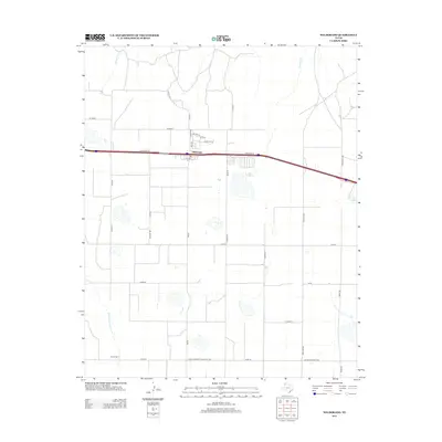
2012 Map of Wildorado
USGS Topo · Published 2012About this map
Wildorado serves as a concentrated hub of settlement amidst the expanse of the Texas Panhandle, defined by its grid of residential streets like Houston St and Main St. The landscape is etched by seasonal drainage patterns, including the headwaters of Wildorado Cr and Pedrosa Cr, while Ida Lake provides a localized water feature to the east. This 2012 survey illustrates a classic High Plains agricultural and transport corridor, where the modern path of Interstate 40 and its Frontage Rd parallel established rural routes.
Find a feature on this map
36 named features on this map. Tap any name to fly to it.
Don’t see what you’re looking for? This feature index may not catch every label — zoom into the map to look around manually.
Map Details
Editions of this 2012 Wildorado Map
This is the sole edition of this map. No revisions or reprints were ever made.
Other maps of this area

1934 · Ady
USGS Topo · 1:62,500

1936 · Ady
USGS Topo · 1:62,500

1954 · Tucumcari
USGS Topo · 1:250,000

1958 · Tucumcari
USGS Topo · 1:250,000

1962 · Wildorado
USGS Topo · 1:62,500

1965 · Everett
USGS Topo · 1:24,000

1965 · Allison Ranch
USGS Topo · 1:24,000

1966 · Jay Taylor Ranch
USGS Topo · 1:24,000
1966 · Wolf Mountain
USGS Topo · 1:24,000

1966 · Rotten Hill
USGS Topo · 1:24,000