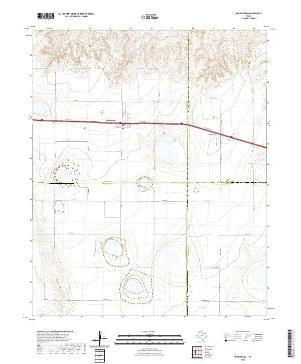
2022 Map of Wildorado
USGS Topo · Published 2022About this map
Wildorado sits at a geographic crossroads in the Texas Panhandle, positioned where the boundaries of Oldham, Potter, Randall, and Deaf Smith counties nearly converge. This high plains landscape is defined by the critical transit corridor of Interstate 40, accompanied by the I-40 Svc Rd and I-40 Frontage Rd. The town itself is compactly organized around Main St and Locust St, serving as a central hub for the surrounding agricultural grid. To the north, the terrain breaks into the drainage systems of Wildorado Cr and Pedrosa Cr, while Ida Lake and N Palo Duro Cr anchor the southeastern and southwestern quadrants respectively. Aviation history is noted by the presence of the J & H Airport located just east of the main settlement. The map captures the enduring rural structure of the region, from the Post Office at the town's heart to the long, straight reaches of Frying Pan Rd and W Farmers Ave.
Find a feature on this map
36 named features on this map. Tap any name to fly to it.
Don’t see what you’re looking for? This feature index may not catch every label — zoom into the map to look around manually.
Map Details
Editions of this 2022 Wildorado Map
This is the sole edition of this map. No revisions or reprints were ever made.
Other maps of this area

1934 · Ady
USGS Topo · 1:62,500

1936 · Ady
USGS Topo · 1:62,500

1954 · Tucumcari
USGS Topo · 1:250,000

1958 · Tucumcari
USGS Topo · 1:250,000

1962 · Wildorado
USGS Topo · 1:62,500

1965 · Everett
USGS Topo · 1:24,000

1965 · Allison Ranch
USGS Topo · 1:24,000

1966 · Jay Taylor Ranch
USGS Topo · 1:24,000
1966 · Wolf Mountain
USGS Topo · 1:24,000

1966 · Rotten Hill
USGS Topo · 1:24,000