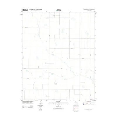
2012 Map of Wildorado SW
USGS Topo · Published 2012About this map
Palo Duro Cr and its northern tributary, N Palo Duro Cr, wind through the High Plains landscape of Randall County in this 2012 survey. The area is characterized by large agricultural tracts and rural infrastructure, including private aviation facilities such as Moore Airport and the Kimball Farm Service Inc Airport. The map highlights the intersection of local transportation and community history, notably at the Palo Duro-Wildorado Cem located along the northern reach of the creek. A network of county roads like Westline Rd and Country Club Rd provides access to the scattered farmsteads and ranches that define this portion of the Texas Panhandle. The presence of Ranch Road 2587 and FM-809 underscores the reliance on state and farm-to-market routes to connect this rural expanse to the broader regional economy.
Find a feature on this map
21 named features on this map. Tap any name to fly to it.
Don’t see what you’re looking for? This feature index may not catch every label — zoom into the map to look around manually.
Map Details
Editions of this 2012 Wildorado SW Map
This is the sole edition of this map. No revisions or reprints were ever made.
Other maps of this area

1954 · Tucumcari
USGS Topo · 1:250,000

1954 · Clovis
USGS Topo · 1:250,000

1958 · Clovis
USGS Topo · 1:250,000

1958 · Tucumcari
USGS Topo · 1:250,000

1961 · Buffalo Lake
USGS Topo · 1:62,500

1962 · Wildorado
USGS Topo · 1:62,500

1965 · Everett
USGS Topo · 1:24,000

1965 · Allison Ranch
USGS Topo · 1:24,000

1971 · Hereford NE
USGS Topo · 1:24,000
1984 · Bivins Lake
USGS Topo · 1:24,000